
(3)
LaneX
LaneX Overview:
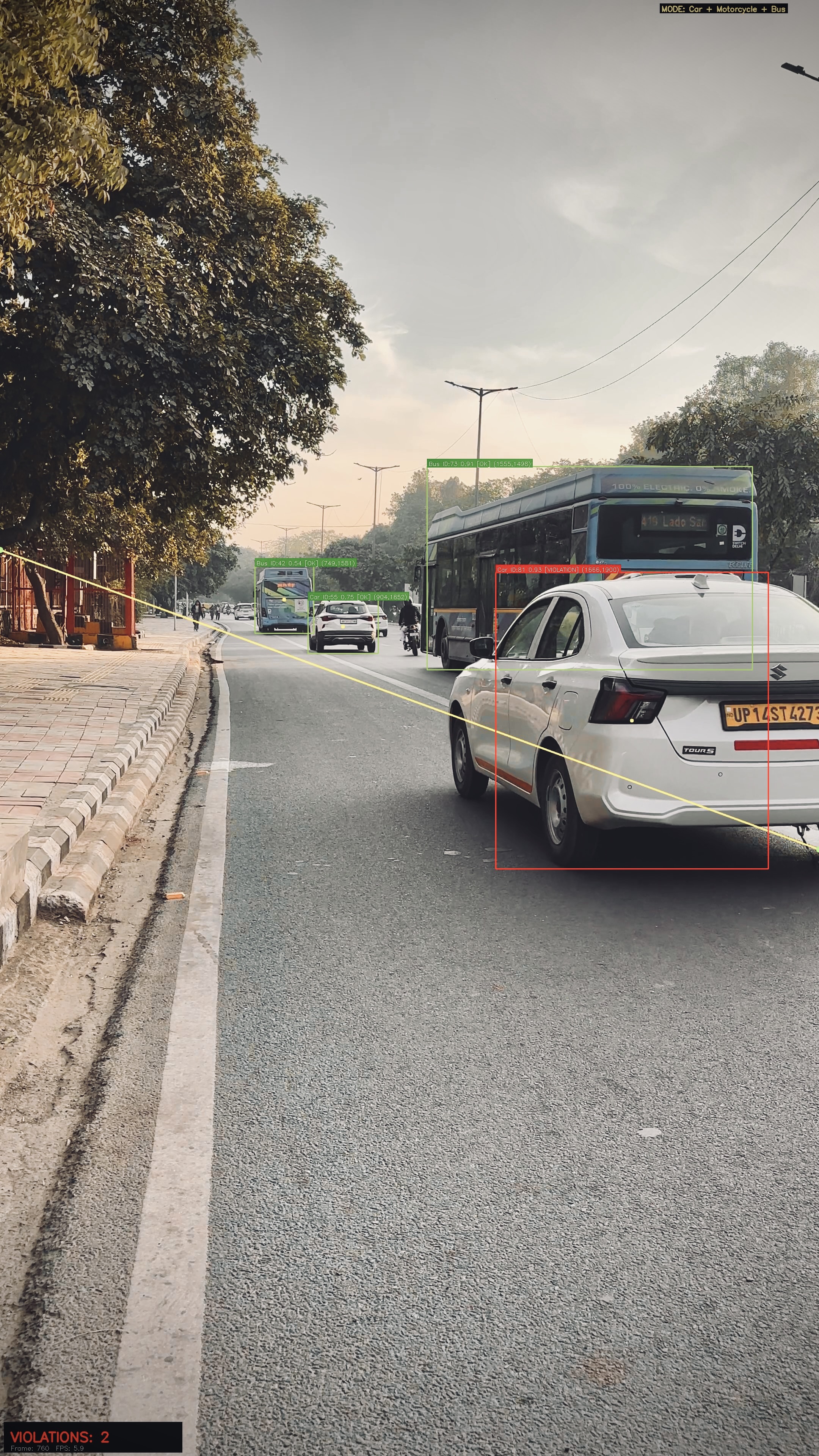
LaneX is an Edge-native Physical AI system engineered for intelligent transportation infrastructure. Architected upon an accelerated YOLOv11s pipeline with ByteTrack-driven Multi-Object Tracking (MOT), it delivers ultra-low-latency inference across complex urban edge environments. By implementing a zero-overhead O(1) state machine and dynamic spatial interpolation algorithms, LaneX achieves deterministic accuracy and a 30% leap in processing throughput for high-scale video analytics.
Key Features
Edge AI Inference • YOLOv11s
Multi-Object Tracking (MOT) • ByteTrack
Dynamic Spatial Algorithms • OpenCV
Scalable Telemetry & Analytics • Matplotlib
Year
2026
Role
AI / Computer Vision Engineer Software Engineer • Backend

Objectives:
Maximize edge inference throughput via early-stage tensor filtering at the tracking layer, yielding a 30% acceleration in real-time processing.
Architect a zero-collision O(1) state management system, ensuring idempotent and deterministic violation telemetry across prolonged object interactions.
Engineer dynamic spatial logic using continuous interpolation, enabling the physical AI to precisely reason about complex road constraints and boundary vectors.
Deploy a hardware-accelerated observability pipeline for high-fidelity H.264 telemetry export, integrating real-time semantic HUD overlays and geospatial heatmaps.
Scope of Work:
The architectural mandate for LaneX centered on engineering a high-performance Edge AI framework and a deterministic spatial reasoning engine:
Edge-Native Tracking: Deploying YOLOv11s alongside ByteTrack to execute early-stage tensor filtering, drastically minimizing NMS overhead and conserving critical GPU memory bandwidth.
Spatial Reasoning Engine: Engineering a continuous interpolation architecture to adaptively map physical road constraints, seamlessly accommodating complex topological depth and diagonal boundary vectors.
Zero-Collision State Management: Architecting a topology-aware O(1) memory structure to enforce idempotent vehicle counting, guaranteeing absolute uniqueness despite prolonged spatial overlap.
Geospatial Telemetry Mapping: Synchronizing real-time tracking streams to autonomously generate high-fidelity trajectory vectors and physical density heatmaps.
Hardware-Accelerated Observability: Integrating specialized subsystems for low-latency H.264 telemetry export, augmented by dynamically rendered semantic HUD interfaces.
An Edge-native Physical AI system that redefines intelligent infrastructure through ultra-low-latency pipeline optimization and deterministic spatial reasoning.

